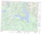
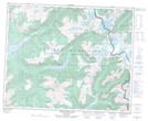
Maps showing Goat Peaks, Kamloops Division Yale Land District, British Columbia
Goat Peaks is a Mountain located in Kamloops Division Yale Land District, British Columbia and has an elevation of 2168 meters.
- Latitude: 52° 14' 18'' North (decimal: 52.2383333)
- Longitude: 119° 58' 20'' West (decimal: -119.9722222)
- Topography Feature Category: Mountain
- Geographical Feature: Peaks
- Canadian Province/Territory: British Columbia
- Elevation: 2168 meters
- Location: Kamloops Division Yale Land District
- Atlas of Canada Locator Map: Goat Peaks
- GPS Coordinate Locator Map: Goat Peaks Lat/Long
Goat Peaks NTS Map Sheets