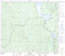
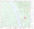
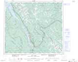
Maps showing Mackenzie, Cariboo Land District, British Columbia
Mackenzie is a District municipality located in Cariboo Land District, British Columbia and has an elevation of 772 meters.
- Latitude: 55° 20' 20'' North (decimal: 55.3388889)
- Longitude: 123° 5' 45'' West (decimal: -123.095833)
- Topography Feature Category: District municipality
- Geographical Feature: District Municipality
- Canadian Province/Territory: British Columbia
- Elevation: 772 meters
- Location: Cariboo Land District
- Atlas of Canada Locator Map: Mackenzie
- GPS Coordinate Locator Map: Mackenzie Lat/Long
Mackenzie NTS Map Sheets