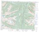
Maps showing Mount Chappell, Kamloops Division Yale Land District, British Columbia
Mount Chappell is a Mountain located in Kamloops Division Yale Land District, British Columbia and has an elevation of 1784 meters.
- Latitude: 52° 23' 47'' North (decimal: 52.3963888)
- Longitude: 119° 13' 9'' West (decimal: -119.2191666)
- Topography Feature Category: Mountain
- Geographical Feature: Mount
- Canadian Province/Territory: British Columbia
- Elevation: 1784 meters
- Location: Kamloops Division Yale Land District
- Atlas of Canada Locator Map: Mount Chappell
- GPS Coordinate Locator Map: Mount Chappell Lat/Long
Mount Chappell NTS Map Sheets