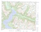
Maps showing Galleon Peak, Range 1 Coast Land District, British Columbia
Galleon Peak is a Mountain located in Range 1 Coast Land District, British Columbia and has an elevation of 1877 meters.
- Latitude: 50° 57' 31'' North (decimal: 50.9586111)
- Longitude: 124° 42' 23'' West (decimal: -124.706389)
- Topography Feature Category: Mountain
- Geographical Feature: Peak
- Canadian Province/Territory: British Columbia
- Elevation: 1877 meters
- Location: Range 1 Coast Land District
- Atlas of Canada Locator Map: Galleon Peak
- GPS Coordinate Locator Map: Galleon Peak Lat/Long
Galleon Peak NTS Map Sheets