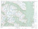
Maps showing Mount Perkins, Lillooet Land District, British Columbia
Mount Perkins is a Mountain located in Lillooet Land District, British Columbia and has an elevation of 2381 meters.
- Latitude: 50° 23' 38'' North (decimal: 50.3938889)
- Longitude: 123° 47' 21'' West (decimal: -123.789167)
- Topography Feature Category: Mountain
- Geographical Feature: Mount
- Canadian Province/Territory: British Columbia
- Elevation: 2381 meters
- Location: Lillooet Land District
- Atlas of Canada Locator Map: Mount Perkins
- GPS Coordinate Locator Map: Mount Perkins Lat/Long
Mount Perkins NTS Map Sheets