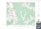
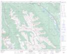
Maps showing Perley Rock, Kootenay Land District, British Columbia
Perley Rock is a Mountain located in Kootenay Land District, British Columbia and has an elevation of 2507 meters.
- Latitude: 51° 15' 18'' North (decimal: 51.2549998)
- Longitude: 117° 26' 1'' West (decimal: -117.4336108)
- Topography Feature Category: Mountain
- Geographical Feature: Spur
- Canadian Province/Territory: British Columbia
- Elevation: 2507 meters
- Location: Kootenay Land District
- Atlas of Canada Locator Map: Perley Rock
- GPS Coordinate Locator Map: Perley Rock Lat/Long
Perley Rock NTS Map Sheets