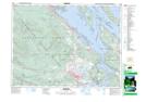
Maps showing Mount Maxwell, Saltspring Island Land District, British Columbia
Mount Maxwell is a Mountain located in Saltspring Island Land District, British Columbia.
- Latitude: 48° 48' 5'' North (decimal: 48.8013890)
- Longitude: 123° 31' 2'' West (decimal: -123.5172230)
- Topography Feature Category: Mountain
- Geographical Feature: Mount
- Canadian Province/Territory: British Columbia
- Location: Saltspring Island Land District
- Atlas of Canada Locator Map: Mount Maxwell
- GPS Coordinate Locator Map: Mount Maxwell Lat/Long