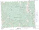
Maps showing Mount Darrah, Kootenay Land District, British Columbia
Mount Darrah is a Mountain located in Kootenay Land District, British Columbia and has an elevation of 2387 meters.
- Latitude: 49° 28' 22'' North (decimal: 49.4727777)
- Longitude: 114° 35' 37'' West (decimal: -114.5936111)
- Topography Feature Category: Mountain
- Geographical Feature: Mount
- Canadian Province/Territory: British Columbia
- Elevation: 2387 meters
- Location: Kootenay Land District
- Atlas of Canada Locator Map: Mount Darrah
- GPS Coordinate Locator Map: Mount Darrah Lat/Long
Mount Darrah NTS Map Sheets