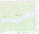
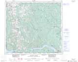
Maps showing Stelck Ridge, Peace River Land District, British Columbia
Stelck Ridge is a Mountain located in Peace River Land District, British Columbia.
- Latitude: 56° 8' 31'' North (decimal: 56.1419444)
- Longitude: 122° 45' 24'' West (decimal: -122.7566666)
- Topography Feature Category: Mountain
- Geographical Feature: Ridge
- Canadian Province/Territory: British Columbia
- Location: Peace River Land District
- Atlas of Canada Locator Map: Stelck Ridge
- GPS Coordinate Locator Map: Stelck Ridge Lat/Long
Stelck Ridge NTS Map Sheets