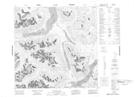
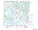
Maps showing Ben-My-Chree, Cassiar Land District, British Columbia
Ben-My-Chree is a Unincorporated area located in Cassiar Land District, British Columbia.
- Latitude: 59° 24' 50'' North (decimal: 59.4138999)
- Longitude: 134° 27' 10'' West (decimal: -134.4528000)
- Topography Feature Category: Unincorporated area
- Geographical Feature: Former Locality
- Canadian Province/Territory: British Columbia
- Location: Cassiar Land District
- Atlas of Canada Locator Map: Ben-My-Chree
- GPS Coordinate Locator Map: Ben-My-Chree Lat/Long