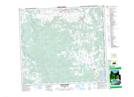
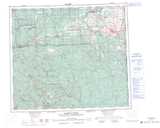
Maps showing Sudeten Park, Peace River Land District, British Columbia
Sudeten Park is a Conservation area located in Peace River Land District, British Columbia and has an elevation of 739 meters.
- Latitude: 55° 32' 25'' North (decimal: 55.5402768)
- Longitude: 120° 4' 7'' West (decimal: -120.0686110)
- Topography Feature Category: Conservation area
- Geographical Feature: Provincial Park
- Canadian Province/Territory: British Columbia
- Elevation: 739 meters
- Location: Peace River Land District
- Atlas of Canada Locator Map: Sudeten Park
- GPS Coordinate Locator Map: Sudeten Park Lat/Long
Sudeten Park NTS Map Sheets