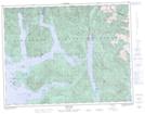
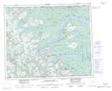
Maps showing Little Zeballos, Nootka Land District, British Columbia
Little Zeballos is a Unincorporated area located in Nootka Land District, British Columbia.
- Latitude: 49° 57' 20'' North (decimal: 49.9555999)
- Longitude: 126° 48' 50'' West (decimal: -126.8139000)
- Topography Feature Category: Unincorporated area
- Geographical Feature: Landing
- Canadian Province/Territory: British Columbia
- Location: Nootka Land District
- GPS Coordinate Locator Map: Little Zeballos Lat/Long
Little Zeballos NTS Map Sheets