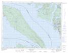
Maps showing Log Boom Cove, Nanaimo Land District, British Columbia
Log Boom Cove is a Bay located in Nanaimo Land District, British Columbia.
- Latitude: 49° 30' North (decimal: 49.5000000)
- Longitude: 124° 13' West (decimal: -124.2167000)
- Topography Feature Category: Bay
- Geographical Feature: Cove
- Canadian Province/Territory: British Columbia
- Location: Nanaimo Land District
- Atlas of Canada Locator Map: Log Boom Cove
- GPS Coordinate Locator Map: Log Boom Cove Lat/Long
Log Boom Cove NTS Map Sheets