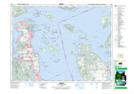
Maps showing Cloake Hill, North Saanich Land District, British Columbia
Cloake Hill is a Mountain located in North Saanich Land District, British Columbia and has an elevation of 63 meters.
- Latitude: 48° 41' 27'' North (decimal: 48.6908328)
- Longitude: 123° 27' 1'' West (decimal: -123.450278)
- Topography Feature Category: Mountain
- Geographical Feature: Hill
- Canadian Province/Territory: British Columbia
- Elevation: 63 meters
- Location: North Saanich Land District
- Atlas of Canada Locator Map: Cloake Hill
- GPS Coordinate Locator Map: Cloake Hill Lat/Long