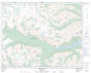
Maps showing Athelney Pass, Lillooet Land District, British Columbia
Athelney Pass is a Valley located in Lillooet Land District, British Columbia and has an elevation of 1856 meters.
- Latitude: 50° 46' 53'' North (decimal: 50.7813889)
- Longitude: 123° 21' 25'' West (decimal: -123.356944)
- Topography Feature Category: Valley
- Geographical Feature: Pass
- Canadian Province/Territory: British Columbia
- Elevation: 1856 meters
- Location: Lillooet Land District
- Atlas of Canada Locator Map: Athelney Pass
- GPS Coordinate Locator Map: Athelney Pass Lat/Long
Athelney Pass NTS Map Sheets