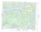
Maps showing Edith Cove, Coast Land District, British Columbia
Edith Cove is a Bay located in Coast Land District, British Columbia.
- Latitude: 50° 30' 12'' North (decimal: 50.5033333)
- Longitude: 125° 36' 19'' West (decimal: -125.605278)
- Topography Feature Category: Bay
- Geographical Feature: Cove
- Canadian Province/Territory: British Columbia
- Location: Coast Land District
- Atlas of Canada Locator Map: Edith Cove
- GPS Coordinate Locator Map: Edith Cove Lat/Long
Edith Cove NTS Map Sheets