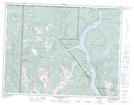
Maps showing Camel Ridge, Nootka Land District, British Columbia
Camel Ridge is a Mountain located in Nootka Land District, British Columbia and has an elevation of 539 meters.
- Latitude: 49° 47' 47'' North (decimal: 49.7963888)
- Longitude: 125° 56' 26'' West (decimal: -125.9405555)
- Topography Feature Category: Mountain
- Geographical Feature: Ridge
- Canadian Province/Territory: British Columbia
- Elevation: 539 meters
- Location: Nootka Land District
- Atlas of Canada Locator Map: Camel Ridge
- GPS Coordinate Locator Map: Camel Ridge Lat/Long
Camel Ridge NTS Map Sheets