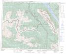
Maps showing Canoe Mountain, Cariboo Land District, British Columbia
Canoe Mountain is a Mountain located in Cariboo Land District, British Columbia and has an elevation of 2439 meters.
- Latitude: 52° 42' 14'' North (decimal: 52.7038888)
- Longitude: 119° 9' 47'' West (decimal: -119.1630555)
- Topography Feature Category: Mountain
- Geographical Feature: Mountain
- Canadian Province/Territory: British Columbia
- Elevation: 2439 meters
- Location: Cariboo Land District
- Atlas of Canada Locator Map: Canoe Mountain
- GPS Coordinate Locator Map: Canoe Mountain Lat/Long
Canoe Mountain NTS Map Sheets