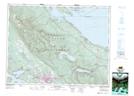
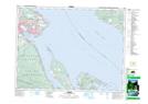
Maps showing Fanny Bay, Newcastle Land District, British Columbia
Fanny Bay is a Unincorporated area located in Newcastle Land District, British Columbia and has an elevation of 13 meters.
- Latitude: 49° 29' 20'' North (decimal: 49.4888999)
- Longitude: 124° 48' 40'' West (decimal: -124.8110999)
- Topography Feature Category: Unincorporated area
- Geographical Feature: Community
- Canadian Province/Territory: British Columbia
- Elevation: 13 meters
- Location: Newcastle Land District
- Atlas of Canada Locator Map: Fanny Bay
- GPS Coordinate Locator Map: Fanny Bay Lat/Long
Fanny Bay NTS Map Sheets