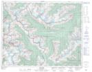
Maps showing Bear Falls, Kootenay Land District, British Columbia
Bear Falls is a Falls located in Kootenay Land District, British Columbia.
- Latitude: 51° 16' 13'' North (decimal: 51.2702777)
- Longitude: 117° 34' 24'' West (decimal: -117.5733333)
- Topography Feature Category: Falls
- Geographical Feature: Falls
- Canadian Province/Territory: British Columbia
- Location: Kootenay Land District
- Atlas of Canada Locator Map: Bear Falls
- GPS Coordinate Locator Map: Bear Falls Lat/Long