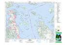
Maps showing Bear Hill, Lake Land District, British Columbia
Bear Hill is a Mountain located in Lake Land District, British Columbia and has an elevation of 138 meters.
- Latitude: 48° 32' 44'' North (decimal: 48.5455555)
- Longitude: 123° 24' 20'' West (decimal: -123.4055555)
- Topography Feature Category: Mountain
- Geographical Feature: Hill
- Canadian Province/Territory: British Columbia
- Elevation: 138 meters
- Location: Lake Land District
- Atlas of Canada Locator Map: Bear Hill
- GPS Coordinate Locator Map: Bear Hill Lat/Long