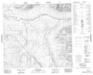
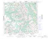
Maps showing Mount Albert Dease, Cassiar Land District, British Columbia
Mount Albert Dease is a Mountain located in Cassiar Land District, British Columbia.
- Latitude: 57° 44' 28'' North (decimal: 57.7411111)
- Longitude: 127° 35' 47'' West (decimal: -127.596389)
- Topography Feature Category: Mountain
- Geographical Feature: Mount
- Canadian Province/Territory: British Columbia
- Location: Cassiar Land District
- Atlas of Canada Locator Map: Mount Albert Dease
- GPS Coordinate Locator Map: Mount Albert Dease Lat/Long
Mount Albert Dease NTS Map Sheets