Maps showing Mount Bagot, Cassiar Land District, British Columbia
Mount Bagot is a Mountain located in Cassiar Land District, British Columbia.
- Latitude: 59° 20' 54'' North (decimal: 59.3483333)
- Longitude: 135° 1' 29'' West (decimal: -135.0247222)
- Topography Feature Category: Mountain
- Geographical Feature: Mount
- Canadian Province/Territory: British Columbia
- Location: Cassiar Land District
- Atlas of Canada Locator Map: Mount Bagot
- GPS Coordinate Locator Map: Mount Bagot Lat/Long
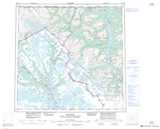
Mount Bagot NTS Map Sheets