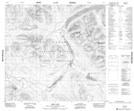
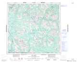
Maps showing Eaglehead Lake, Cassiar Land District, British Columbia
Eaglehead Lake is a Lake located in Cassiar Land District, British Columbia.
- Latitude: 58° 33' 3'' North (decimal: 58.5508333)
- Longitude: 129° 14' 34'' West (decimal: -129.242778)
- Topography Feature Category: Lake
- Geographical Feature: Lake
- Canadian Province/Territory: British Columbia
- Location: Cassiar Land District
- Atlas of Canada Locator Map: Eaglehead Lake
- GPS Coordinate Locator Map: Eaglehead Lake Lat/Long