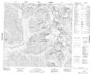
Maps showing Cyclops Peak, Cassiar Land District, British Columbia
Cyclops Peak is a Mountain located in Cassiar Land District, British Columbia and has an elevation of 2406 meters.
- Latitude: 57° 22' 41'' North (decimal: 57.3780556)
- Longitude: 124° 10' 42'' West (decimal: -124.178333)
- Topography Feature Category: Mountain
- Geographical Feature: Peak
- Canadian Province/Territory: British Columbia
- Elevation: 2406 meters
- Location: Cassiar Land District
- Atlas of Canada Locator Map: Cyclops Peak
- GPS Coordinate Locator Map: Cyclops Peak Lat/Long