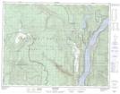
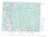
Maps showing The Needles, Kootenay Land District, British Columbia
The Needles is a Channel located in Kootenay Land District, British Columbia and has an elevation of 446 meters.
- Latitude: 49° 51' 58'' North (decimal: 49.8661111)
- Longitude: 118° 5' 47'' West (decimal: -118.0963888)
- Topography Feature Category: Channel
- Geographical Feature: Narrows
- Canadian Province/Territory: British Columbia
- Elevation: 446 meters
- Location: Kootenay Land District
- Atlas of Canada Locator Map: The Needles
- GPS Coordinate Locator Map: The Needles Lat/Long