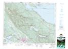
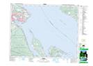
Maps showing Denman Island, Nanaimo Land District, British Columbia
Denman Island is a Island located in Nanaimo Land District, British Columbia and has an elevation of 53 meters.
- Latitude: 49° 32' 45'' North (decimal: 49.5458333)
- Longitude: 124° 47' 31'' West (decimal: -124.791944)
- Topography Feature Category: Island
- Geographical Feature: Island
- Canadian Province/Territory: British Columbia
- Elevation: 53 meters
- Location: Nanaimo Land District
- Atlas of Canada Locator Map: Denman Island
- GPS Coordinate Locator Map: Denman Island Lat/Long
Denman Island NTS Map Sheets