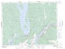
Maps showing Hemlock Valley, New Westminster Land District, British Columbia
Hemlock Valley is a Unincorporated area located in New Westminster Land District, British Columbia and has an elevation of 1031 meters.
- Latitude: 49° 22' 37'' North (decimal: 49.3769443)
- Longitude: 121° 56' 7'' West (decimal: -121.9352776)
- Topography Feature Category: Unincorporated area
- Geographical Feature: Recreational Community
- Canadian Province/Territory: British Columbia
- Elevation: 1031 meters
- Location: New Westminster Land District
- Atlas of Canada Locator Map: Hemlock Valley
- GPS Coordinate Locator Map: Hemlock Valley Lat/Long