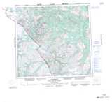
Maps showing Peridotite Peak, Cassiar Land District, British Columbia
Peridotite Peak is a Mountain located in Cassiar Land District, British Columbia.
- Latitude: 58° 58' 46'' North (decimal: 58.9794444)
- Longitude: 132° 45' 11'' West (decimal: -132.7530555)
- Topography Feature Category: Mountain
- Geographical Feature: Peak
- Canadian Province/Territory: British Columbia
- Location: Cassiar Land District
- Atlas of Canada Locator Map: Peridotite Peak
- GPS Coordinate Locator Map: Peridotite Peak Lat/Long
Peridotite Peak NTS Map Sheets