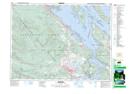
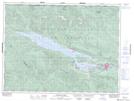
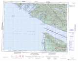
Maps showing Hill 60 Ridge, Cowichan Lake Land District, British Columbia
Hill 60 Ridge is a Mountain located in Cowichan Lake Land District, British Columbia and has an elevation of 918 meters.
- Latitude: 48° 51' 18'' North (decimal: 48.8550000)
- Longitude: 124° 1' 1'' West (decimal: -124.0169444)
- Topography Feature Category: Mountain
- Geographical Feature: Ridge
- Canadian Province/Territory: British Columbia
- Elevation: 918 meters
- Location: Cowichan Lake Land District
- Atlas of Canada Locator Map: Hill 60 Ridge
- GPS Coordinate Locator Map: Hill 60 Ridge Lat/Long
Hill 60 Ridge NTS Map Sheets