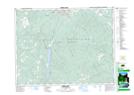
Maps showing Hogg Creek, Kootenay Land District, British Columbia
Hogg Creek is a River located in Kootenay Land District, British Columbia and has an elevation of 968 meters.
- Latitude: 49° 23' 25'' North (decimal: 49.3902777)
- Longitude: 115° 49' 10'' West (decimal: -115.8194444)
- Topography Feature Category: River
- Geographical Feature: Creek
- Canadian Province/Territory: British Columbia
- Elevation: 968 meters
- Location: Kootenay Land District
- Atlas of Canada Locator Map: Hogg Creek
- GPS Coordinate Locator Map: Hogg Creek Lat/Long