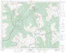
Maps showing Downie, Kootenay Land District, British Columbia
Downie is a Unincorporated area located in Kootenay Land District, British Columbia.
- Latitude: 51° 9' 21'' North (decimal: 51.1558333)
- Longitude: 117° 48' 44'' West (decimal: -117.8122222)
- Topography Feature Category: Unincorporated area
- Geographical Feature: Railway Point
- Canadian Province/Territory: British Columbia
- Location: Kootenay Land District
- Atlas of Canada Locator Map: Downie
- GPS Coordinate Locator Map: Downie Lat/Long
Downie NTS Map Sheets