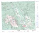
Maps showing Driftwood Creek, Range 5 Coast Land District, British Columbia
Driftwood Creek is a Unincorporated area located in Range 5 Coast Land District, British Columbia and has an elevation of 661 meters.
- Latitude: 54° 49' 00'' North (decimal: 54.8166666)
- Longitude: 127° 4' 45'' West (decimal: -127.0791666)
- Topography Feature Category: Unincorporated area
- Geographical Feature: Community
- Canadian Province/Territory: British Columbia
- Elevation: 661 meters
- Location: Range 5 Coast Land District
- Atlas of Canada Locator Map: Driftwood Creek
- GPS Coordinate Locator Map: Driftwood Creek Lat/Long