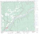
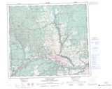
Maps showing Hudson Hope, Peace River Land District, British Columbia
Hudson Hope is a Unincorporated area located in Peace River Land District, British Columbia and has an elevation of 500 meters.
- Latitude: 56° 1' 55'' North (decimal: 56.0319000)
- Longitude: 121° 52' 25'' West (decimal: -121.8736000)
- Topography Feature Category: Unincorporated area
- Geographical Feature: Post Office
- Canadian Province/Territory: British Columbia
- Elevation: 500 meters
- Location: Peace River Land District
- GPS Coordinate Locator Map: Hudson Hope Lat/Long
Hudson Hope NTS Map Sheets