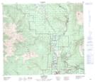
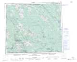
Maps showing Tenas Hill, Cassiar Land District, British Columbia
Tenas Hill is a Mountain located in Cassiar Land District, British Columbia and has an elevation of 692 meters.
- Latitude: 55° 26' 54'' North (decimal: 55.4483333)
- Longitude: 127° 39' 19'' West (decimal: -127.655278)
- Topography Feature Category: Mountain
- Geographical Feature: Hill
- Canadian Province/Territory: British Columbia
- Elevation: 692 meters
- Location: Cassiar Land District
- Atlas of Canada Locator Map: Tenas Hill
- GPS Coordinate Locator Map: Tenas Hill Lat/Long