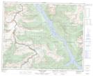
Maps showing Pancake Peak, Cariboo Land District, British Columbia
Pancake Peak is a Mountain located in Cariboo Land District, British Columbia and has an elevation of 2718 meters.
- Latitude: 52° 16' 19'' North (decimal: 52.2719444)
- Longitude: 118° 51' 40'' West (decimal: -118.8611111)
- Topography Feature Category: Mountain
- Geographical Feature: Peak
- Canadian Province/Territory: British Columbia
- Elevation: 2718 meters
- Location: Cariboo Land District
- Atlas of Canada Locator Map: Pancake Peak
- GPS Coordinate Locator Map: Pancake Peak Lat/Long
Pancake Peak NTS Map Sheets