Maps showing Dease Plateau, Cassiar Land District, British Columbia
Dease Plateau is a Plain located in Cassiar Land District, British Columbia and has an elevation of 826 meters.
- Latitude: 59° 35' North (decimal: 59.5833000)
- Longitude: 129° 30' West (decimal: -129.5000000)
- Topography Feature Category: Plain
- Geographical Feature: Plateau
- Canadian Province/Territory: British Columbia
- Elevation: 826 meters
- Location: Cassiar Land District
- Atlas of Canada Locator Map: Dease Plateau
- GPS Coordinate Locator Map: Dease Plateau Lat/Long
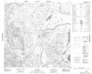
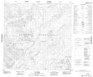
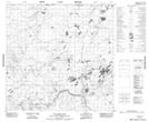
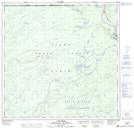
Dease Plateau NTS Map Sheets
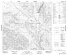
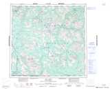
104O16 No Title Topographic Map at 1:50,000 scale
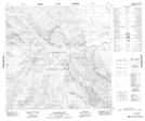
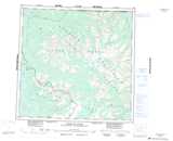
104P02 Julian Creek Topographic Map at 1:50,000 scale
104P07 Johnny Creek Topographic Map at 1:50,000 scale
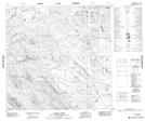
104P08 Deadwood River Topographic Map at 1:50,000 scale
104P09 Mustela Creek Topographic Map at 1:50,000 scale
104P10 No Title Topographic Map at 1:50,000 scale
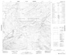
104P11 Dot Lake Topographic Map at 1:50,000 scale
104P12 Blue Dome Topographic Map at 1:50,000 scale
104P13 One Ace Mountain Topographic Map at 1:50,000 scale
104P14 Old Faddy Lake Topographic Map at 1:50,000 scale
104P15 Lutz Creek Topographic Map at 1:50,000 scale
104I Cry Lake Topographic Map at 1:250,000 scale
104O Jennings River Topographic Map at 1:250,000 scale
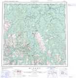
104P Mcdame Topographic Map at 1:250,000 scale