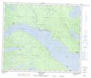
Maps showing Duck Point, Range 5 Coast Land District, British Columbia
Duck Point is a Cape located in Range 5 Coast Land District, British Columbia and has an elevation of 683 meters.
- Latitude: 54° 39' 10'' North (decimal: 54.6527777)
- Longitude: 124° 46' 18'' West (decimal: -124.7716666)
- Topography Feature Category: Cape
- Geographical Feature: Point
- Canadian Province/Territory: British Columbia
- Elevation: 683 meters
- Location: Range 5 Coast Land District
- Atlas of Canada Locator Map: Duck Point
- GPS Coordinate Locator Map: Duck Point Lat/Long
Duck Point NTS Map Sheets