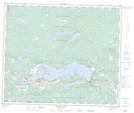
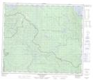
Maps showing Duncan Creek, Range 5 Coast Land District, British Columbia
Duncan Creek is a River located in Range 5 Coast Land District, British Columbia and has an elevation of 931 meters.
- Latitude: 54° 18' 56'' North (decimal: 54.3155556)
- Longitude: 124° 48' 27'' West (decimal: -124.8075)
- Topography Feature Category: River
- Geographical Feature: Creek
- Canadian Province/Territory: British Columbia
- Elevation: 931 meters
- Location: Range 5 Coast Land District
- Atlas of Canada Locator Map: Duncan Creek
- GPS Coordinate Locator Map: Duncan Creek Lat/Long
Duncan Creek NTS Map Sheets