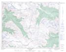
Maps showing Wahoo Tower, Lillooet Land District, British Columbia
Wahoo Tower is a Mountain located in Lillooet Land District, British Columbia.
- Latitude: 50° 36' 42'' North (decimal: 50.6116667)
- Longitude: 123° 45' 56'' West (decimal: -123.765556)
- Topography Feature Category: Mountain
- Geographical Feature: Tower
- Canadian Province/Territory: British Columbia
- Location: Lillooet Land District
- Atlas of Canada Locator Map: Wahoo Tower
- GPS Coordinate Locator Map: Wahoo Tower Lat/Long
Wahoo Tower NTS Map Sheets