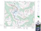
Maps showing McDonell Peak, Cariboo Land District, British Columbia
McDonell Peak is a Mountain located in Cariboo Land District, British Columbia and has an elevation of 2956 meters.
- Latitude: 52° 39' 5'' North (decimal: 52.6513888)
- Longitude: 118° 18' 22'' West (decimal: -118.3061111)
- Topography Feature Category: Mountain
- Geographical Feature: Peak
- Canadian Province/Territory: British Columbia
- Elevation: 2956 meters
- Location: Cariboo Land District
- Atlas of Canada Locator Map: McDonell Peak
- GPS Coordinate Locator Map: McDonell Peak Lat/Long
McDonell Peak NTS Map Sheets