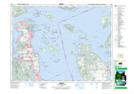
Maps showing Dyer Rocks, Cowichan Land District, British Columbia
Dyer Rocks is a Shoal located in Cowichan Land District, British Columbia and has an elevation of 3 meters.
- Latitude: 48° 37' 33'' North (decimal: 48.6258333)
- Longitude: 123° 28' 47'' West (decimal: -123.479722)
- Topography Feature Category: Shoal
- Geographical Feature: Rocks
- Canadian Province/Territory: British Columbia
- Elevation: 3 meters
- Location: Cowichan Land District
- Atlas of Canada Locator Map: Dyer Rocks
- GPS Coordinate Locator Map: Dyer Rocks Lat/Long