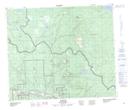
Maps showing Tachek Mountain, Range 5 Coast Land District, British Columbia
Tachek Mountain is a Mountain located in Range 5 Coast Land District, British Columbia and has an elevation of 1503 meters.
- Latitude: 54° 36' 3'' North (decimal: 54.6008333)
- Longitude: 126° 13' 57'' West (decimal: -126.2325)
- Topography Feature Category: Mountain
- Geographical Feature: Mountain
- Canadian Province/Territory: British Columbia
- Elevation: 1503 meters
- Location: Range 5 Coast Land District
- Atlas of Canada Locator Map: Tachek Mountain
- GPS Coordinate Locator Map: Tachek Mountain Lat/Long