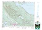
Maps showing Mount Schofield, Newcastle Land District, British Columbia
Mount Schofield is a Mountain located in Newcastle Land District, British Columbia and has an elevation of 952 meters.
- Latitude: 49° 23' 54'' North (decimal: 49.3983333)
- Longitude: 124° 47' 58'' West (decimal: -124.7994444)
- Topography Feature Category: Mountain
- Geographical Feature: Mount
- Canadian Province/Territory: British Columbia
- Elevation: 952 meters
- Location: Newcastle Land District
- Atlas of Canada Locator Map: Mount Schofield
- GPS Coordinate Locator Map: Mount Schofield Lat/Long
Mount Schofield NTS Map Sheets