Canada Topographic Maps

Tahtsa River Topo Maps

Topography maps and Latitude/Longitude Location

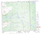
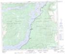
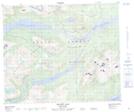
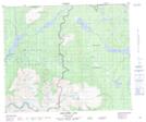
Maps showing Tahtsa River, Range 4 Coast Land District, British Columbia

Tahtsa River is a River located in Range 4 Coast Land District, British Columbia.

  • Latitude: 53° 42' North   (decimal: 53.6999999)
  • Longitude: 127° 4' West   (decimal: -127.0666999)
  • Topography Feature Category: River
  • Geographical Feature: River
  • Canadian Province/Territory: British Columbia
  • Location: Range 4 Coast Land District
  • GPS Coordinate Locator Map: Tahtsa River Lat/Long

Tahtsa River NTS Map Sheets

093E09 Ghitezli Lake Topographic Map at 1:50,000 scale

093E10 Whitesail Reach Topographic Map at 1:50,000 scale

093E11 Troitsa Lake Topographic Map at 1:50,000 scale

093E14 Newcombe Lake Topographic Map at 1:50,000 scale

093E15 Nadina River Topographic Map at 1:50,000 scale

093E Whitesail Lake Topographic Map at 1:250,000 scale

 
Buy Topographic Maps DVD
Newsletter Sign-up

Yes, I want to receive map store discounts.


Bookmark and Share