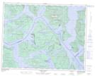
Maps showing Octopus Islands Marine Park, Sayward Land District, British Columbia
Octopus Islands Marine Park is a Conservation area located in Sayward Land District, British Columbia and has an elevation of 14 meters.
- Latitude: 50° 16' 45'' North (decimal: 50.2791666)
- Longitude: 125° 13' 50'' West (decimal: -125.2305555)
- Topography Feature Category: Conservation area
- Geographical Feature: Provincial Marine Park
- Canadian Province/Territory: British Columbia
- Elevation: 14 meters
- Location: Sayward Land District
- Atlas of Canada Locator Map: Octopus Islands Marine Park
- GPS Coordinate Locator Map: Octopus Islands Marine Park Lat/Long
Octopus Islands Marine Park NTS Map Sheets