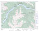
Maps showing Ohin Creek, Lillooet Land District, British Columbia
Ohin Creek is a River located in Lillooet Land District, British Columbia and has an elevation of 1324 meters.
- Latitude: 50° 43' 28'' North (decimal: 50.7244000)
- Longitude: 122° 11' 30'' West (decimal: -122.1917000)
- Topography Feature Category: River
- Geographical Feature: Creek
- Canadian Province/Territory: British Columbia
- Elevation: 1324 meters
- Location: Lillooet Land District
- Atlas of Canada Locator Map: Ohin Creek
- GPS Coordinate Locator Map: Ohin Creek Lat/Long