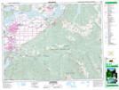
Maps showing Teapot Hill, New Westminster Land District, British Columbia
Teapot Hill is a Mountain located in New Westminster Land District, British Columbia and has an elevation of 214 meters.
- Latitude: 49° 1' 50'' North (decimal: 49.0305555)
- Longitude: 121° 59' 44'' West (decimal: -121.9955555)
- Topography Feature Category: Mountain
- Geographical Feature: Hill
- Canadian Province/Territory: British Columbia
- Elevation: 214 meters
- Location: New Westminster Land District
- Atlas of Canada Locator Map: Teapot Hill
- GPS Coordinate Locator Map: Teapot Hill Lat/Long