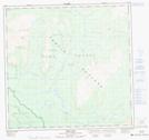
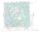
Maps showing Sentinel Mountain, Cassiar Land District, British Columbia
Sentinel Mountain is a Mountain located in Cassiar Land District, British Columbia.
- Latitude: 59° 26' 18'' North (decimal: 59.4383333)
- Longitude: 133° 26' 15'' West (decimal: -133.4375000)
- Topography Feature Category: Mountain
- Geographical Feature: Mountain
- Canadian Province/Territory: British Columbia
- Location: Cassiar Land District
- Atlas of Canada Locator Map: Sentinel Mountain
- GPS Coordinate Locator Map: Sentinel Mountain Lat/Long