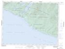
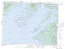
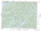
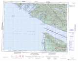
Maps showing Somerset Range, Barclay Land District, British Columbia
Somerset Range is a Mountain located in Barclay Land District, British Columbia and has an elevation of 207 meters.
- Latitude: 48° 47' 41'' North (decimal: 48.7947222)
- Longitude: 124° 59' 34'' West (decimal: -124.9927777)
- Topography Feature Category: Mountain
- Geographical Feature: Range
- Canadian Province/Territory: British Columbia
- Elevation: 207 meters
- Location: Barclay Land District
- Atlas of Canada Locator Map: Somerset Range
- GPS Coordinate Locator Map: Somerset Range Lat/Long
Somerset Range NTS Map Sheets